Table of Contents:
- Relief
- Drainage
- Catchment areas
- Drainage Basin
- Watershed
- Drainage System
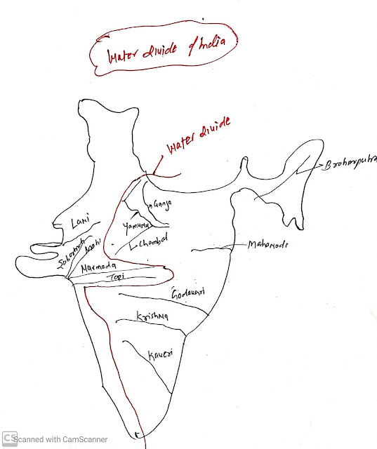
- Water divide of India
- Drainage pattern
- Himalayan drainage system
- Peninsular drainage system
- Comparison of Himalayan and Peninsular drainage system
- Previous Years question related to Relief and drainage
What is the relief?
Relief in particular areas means the highest and lowest elevation point of an area or vertical height from sea level.
For examples,
Relief of earth surface:
- Highest point- Mount Everest(8850 meters )
- Lowest point- Mariana Trench(11034 meters)
- Relief of earth surface=8850+ 11034= 19884 meters
Relief of India:
- Highest point: k2: 8611 meters
- The lowest point; sea level
- Relief of India= 8611 meters
- The altitudinal difference between the highest point of the mountain peak and the lowest point of the deep gorge valley.
Relief gives information about the terrain.
- The topographic map is used to represent the relief landforms on maps by drawing contour lines.
- Examples,
- Plain topography
- Hills topography
- Plateau topography
Drainage:
The flow of water through the well-defined channel is known as "drainage". It can be natural drainages such as rivers or artificial drainage such as a canal.Catchment areas
A river drains the water collected from specific areas is called catchment areas.
Drainage basins
An area drained by the river and its tributaries is called drainage basins or Catchment areas of the larger river is called river basin.Drainage System:
The network of channels or drainage is called the drainage system. The network of channels includes the main river with ll its tributaries.
For example:
Indus river system or Indus Drainage System
Ganga Drainage System
Godavry drainage basin
Watershed:
Watershed is a geographical unit of land in which water drains through a common point. Watershed is small in areas while the basin covers larger areas.

ConversionConversion EmoticonEmoticon